Rising from the San Gabriel Valley to the north of Los Angeles, the San Gabriel Mountains provide an iconic backdrop to the sprawling urban expanse below. This mountain range isn’t just a scenic feature; it also reveals key insights about the Earth’s history, society, and our connection to nature.
The mountain range is part of the Transverse Ranges lying between the Los Angeles Basin and the Mojave Desert, the largest desert in North America. The range is straddled by Interstate 5 to the west and Interstate 15 to the east. Incorporated within the range are the Angeles and San Bernardino National Forests, with the San Andreas Fault as its northern border.

The San Gabriel Mountains offer an impressive rise in elevation. While the foothills begin at nearly sea level, the highest point in the range is Mount San Antonio, often known as Mount Baldy. This peak reaches an altitude of 10,064 feet (3,068 meters). The quick transition from the bustling city to towering peaks is something that’s part of the magic of these mountains, a dramatic wall of tectonic force standing guard over downtown Los Angeles.
While the San Gabriels are much smaller in terms of length than, say the Appalachians, they are significantly taller on average. The highest peak in the Appalachians, Mount Mitchell in North Carolina, reaches 6,684 feet (2,037 meters). That’s considerably lower than Mount Baldy in the San Gabriels. The San Gabriels, therefore, boast higher peaks even though they cover a smaller area. However, compared to the Appalachians, which are thought to be billions of years old, the San Gabriel Mountains are relatively young, geologically speaking, and are characterized by rugged and steep features. In essence, being younger, they’ve undergone less erosion.

It is believed that much of the sand on California’s legendary beaches originated in the San Gabriel mountains, the result of erosion and various rivers and streams that run into the Pacific Ocean.
To understand the story of the San Gabriel Mountains, we need to embark on a temporal journey spanning millions of years. The mountains’ tale starts about 100 million years ago, during the Mesozoic Era, when massive tectonic plates—the Pacific and North American plates—began to converge. The interaction of these tectonic plates was dramatic, with the Pacific Plate subducting, or diving beneath, the North American Plate. This subduction caused the rocks to melt and, over time, rise to form granitic masses known as plutons.

As the ages rolled on, these plutons were uplifted, and the erosion of the surrounding softer rocks exposed the granitic cores, giving birth to the San Gabriel Mountains we see today. The primary rock composition of these mountains is granite, with large-grained crystals of feldspar, quartz, and mica that glitter when the sun kisses their surfaces. These mountains also feature significant deposits of sedimentary rocks, particularly in the lower elevations, which date back to the Mesozoic and Cenozoic eras.

Purchase stunning art prints of iconic California scenes.
Check out our Etsy store.
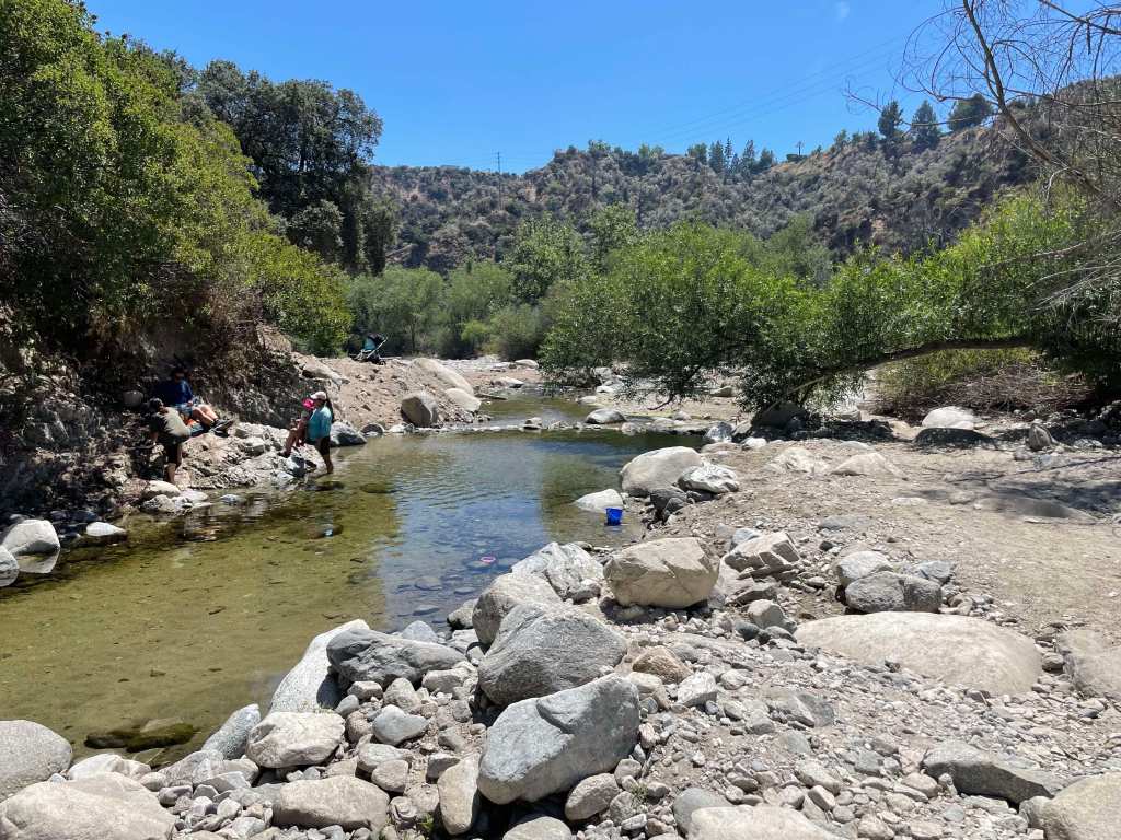
The drainage system of the San Gabriel Mountains is defined by numerous canyons, streams, and arroyos that channel water down from the high elevations into the valleys below. The Arroyo Seco, one of the most well-known waterways, begins near Mount Wilson and flows southwest through Pasadena before merging with the Los Angeles River. Other important streams include the Big Tujunga Creek, which cuts through the mountains to feed into the San Fernando Valley, and the San Gabriel River, which drains much of the range’s eastern side. These waterways are seasonal, swelling during winter rains and spring snowmelt, and often run dry during summer months. Their canyons have been carved by the relentless forces of erosion, creating deep ravines that are vital for wildlife and plant habitats.

The San Gabriel Mountains play a critical role in the watershed that serves the greater Los Angeles area. Rain and snowmelt from the mountains replenish groundwater basins and feed into reservoirs, such as the San Gabriel Reservoir and the Morris Reservoir, which are essential for water supply. These mountains act as a natural guidance system, capturing precipitation and funneling it into the region’s aquifers and rivers, supporting both the municipal water supply and flood control efforts. The watershed is crucial for Los Angeles, which depends on these local sources of water to supplement imported supplies from distant regions like the Colorado River and the Owens Valley. The mountain runoff helps maintain the flow of the Los Angeles River, contributing to the city’s efforts to recharge groundwater and ensure a reliable water supply in this semi-arid region.

Visit the California Curated store on Etsy for original prints showing the beauty and natural wonder of California.
When it rains it pours, and sometimes causes landslides
Flood control has long been a central concern in managing the water systems of the San Gabriel Mountains, particularly due to the area’s vulnerability to intense, episodic storms. The steep slopes of the mountains funnel rainwater rapidly into urban areas, leading to a heightened risk of flash floods and debris flows. Over time, this led to the construction of a vast network of catchment basins, dams, and debris basins at the foot of the mountains. These basins are designed to capture stormwater runoff, preventing the overflow of water into densely populated areas and managing the sediment and debris that comes with mountain runoff, which can clog waterways and exacerbate flooding.
Catchment basins in the San Gabriel Mountains are critical for controlling debris flows that occur during and after heavy rains, which can be particularly dangerous in areas where wildfires have stripped the landscape of vegetation. When intense rainstorms hit the steep, fire-scarred slopes, they trigger massive torrents of mud, boulders, and tree debris that rush down the mountain canyons toward the urban foothills. These debris flows can overwhelm creeks and spill into residential neighborhoods, causing widespread destruction. The catchment basins are designed to trap this debris before it reaches populated areas, but their effectiveness depends on regular maintenance and clearing. When these basins fill up too quickly or are not properly maintained, debris can overtop them, leading to significant flooding and property damage.

A stark example of the dangers posed by debris flows occurred in Montrose in 1934. Following a series of intense storms in the aftermath of the New Year’s Day floods, massive debris flows roared out of the San Gabriel Mountains, devastating the communities of Montrose, La Crescenta, and Tujunga. The floods and debris flows buried homes and roads under several feet of mud and debris, killing at least 45 people. The Montrose landslide became a tragic reminder of the risks associated with living near the San Gabriel Mountains, particularly in the face of severe weather. This event spurred greater investments in flood control infrastructure, including the construction of more robust debris basins to mitigate the effects of future storms.
A fascinating article on the efforts to control debris flows from the San Gabriels, though a bit dated, was penned by John McPhee—whose work we greatly admire. It remains a deeply engaging read on the subject.
Historical Significance: From the Grave to Mt. Wilson
The San Gabriel Mountains aren’t just a spectacle of natural processes; they’ve also been a silent witness to numerous significant historical events. The grave of Owen Brown can be found in the mountains just outside of La Canada Flintridge. Owen was the third son of abolitionist John Brown, and has a resting place that has stirred intrigue and speculation for generations. Owen’s grave has become a kind of pilgrimage site for those interested in American history.

nearly a decade after his death. Photo: Brown family and Paul Ayers.
Owen Brown was a fervent abolitionist like his father and participated in the famous raid on Harpers Ferry. After the tumultuous events that marked his early life, he moved to California, seeking solace in the west. He settled near El Prieto Canyon and lived a relatively secluded life. After his death in 1889, he was buried on a hillside overlooking the canyon, and his grave was marked with a simple headstone. Over time, nature, vandals, and other factors led to the original headstone’s disappearance, adding a layer of mystique to the grave’s location. However, in 2019, a replica of the gravestone was installed.

Mount Wilson is another historical wonder in the range. Standing at a towering height of 5,710 feet, it’s not just its elevation that sets Mt. Wilson apart. In the early 20th century, the Mount Wilson Observatory was established, and it soon became a hub of astronomical discoveries. It was here that Edwin Hubble, using the Hooker Telescope, provided evidence of the expansion of the universe—a groundbreaking observation that eventually led to the Big Bang Theory.
Infrastructure Marvel: The Angeles Crest Highway
The human connection to the San Gabriel Mountains was further cemented with the construction of the Angeles Crest Highway in the 1930s. Spanning approximately 66 miles, this scenic byway was a colossal engineering challenge. Its creation provided access to previously remote regions and breathtaking panoramic views that today lure thousands of tourists and nature enthusiasts. The highway is also one of the highest in Southern California, with a summit of 7,903 feet at the Dawson Saddle.

Driving on the Angeles Crest Highway is an experience that’s both thrilling and a bit nerve-wracking. Winding and twisting through the mountains, you can come across steep drop-offs, sharp turns, and narrow lanes. With elevation changes ranging from around 1,200 feet to more than 7,900 feet, it’s a route that demands respect and attention from those behind the wheel.
Flora, Fauna, and Natural History: A Biodiversity Hotspot
Beyond geology and history, the San Gabriel Mountains are a treasure trove of biodiversity. The montane environment, with its varied elevation and climate zones, has given rise to a rich tapestry of flora and fauna. Iconic trees like the Jeffrey pine, Coulter pine, and California black oak adorn the landscape. Wildflowers paint the meadows in vibrant hues, from the golden yarrow to the scarlet larkspur.
The fauna is just as diverse, with animals like the California condor, bighorn sheep, and mountain lions roaming the rugged terrain. The waters that trickle and rush down these mountains are home to arroyo chubs and Santa Ana suckers.

Protection of this vital ecosystem came in the form of the San Gabriel Mountains National Monument designation in 2014, ensuring that the mountains’ rich biodiversity and cultural significance will be preserved for generations.
The San Gabriel Mountains are more than just a scenic backdrop. They reflect the Earth’s active geology, hold key historical moments, and support diverse ecosystems. Amid growing urbanization, these mountains remain a lasting reminder of the interconnectedness of life, history, and natural forces.


